
 Hadean time is not a geological period as such. No rocks on the Earth are this old - except for meteorites. During Hadean time, the Solar System was forming, probably within a large cloud of gas and dust around the sun, called an accretion disc. The relative abundance of heavier elements in the Solar System suggests that this gas and dust was derived from a supernova, or supernovas - the explosion of an old, massive star. Heavier elements are generated within stars by nuclear fusion of hydrogen, and are otherwise uncommon. We can see similar processes taking place today in so-called diffuse nebulae in this and other galaxies - such as the nebula M16, shown above left.
The sun formed within such a cloud of gas and dust, shrinking in on itself by gravitational compaction until it began to undergo nuclear fusion and give off light and heat. Surrounding particles began to coalesce by gravity into larger lumps, or planetesimals, which continued to aggregate into planets. "Left-over" material formed asteroids and comets - like asteroid Ida, on the upper right.
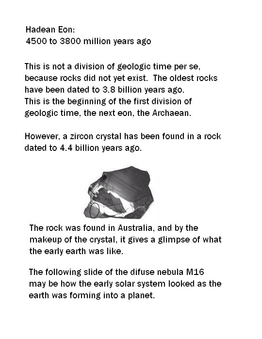
Because collisions between large planetesimals release a lot of heat, the Earth and other planets would have been molten at the beginning of their histories. Solidification of the molten material into rocks happened as the Earth cooled. The oldest meteorites and lunar rocks are about 4.5 billion years old, but the oldest Earth rocks currently known are 3.8 billion years old. Sometime during the first 800 million or so years of its history, the surface of the Earth changed from liquid to solid. Once solid rock formed on the Earth, its geological history began. This most likely happened prior to 3.8 billion years, but hard evidence for this is lacking. Erosion and plate tectonics has probably destroyed all of the solid rocks that were older than 3.8 billion years. The beginning of the rock record that is currently present on the Earth is the inception of a time known as the Archaean.
Most of this is from the Enchanted Learning website on geologic time. See the link on the sidebar.


 Please be careful where you step!
Here is the discussion on the Archaean Eon from Enchanted Learning.
If you were able to travel back to visit the Earth during the Archaean, you would likely not recognize it is the same planet we inhabit today. The atmosphere was very different from what we breathe today; at that time, it was likely a reducing atmosphere of methane, ammonia, and other gases which would be toxic to most life on our planet today. Also during this time, the Earth's crust cooled enough that rocks and continental plates began to form.
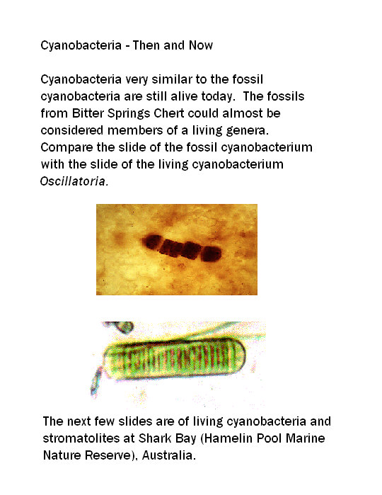
It was early in the Archaean that life first appeared on Earth. Our oldest fossils date to roughly 3.5 billion years ago, and consist of bacteria microfossils. In fact, all life during the more than one billion years of the Archaean was bacterial. At right is an artist's depiction of what an Archaean coast might have looked like 3.5 billion years ago. The mounds in the foreground are stromatolites, colonies of photosynthetic bacteria which have been found as fossils in Early Archaean rocks of South Africa and Western Australia. Stromatolites increased in abundance throughout the Archaean, but began to decline during the Proterozoic. They are not common today.
Next time, The Archaeans. This is a previously unknown life form, which has been identified by it's DNA.
Need to know more: Chert
This is a nice article. I'll just link to it here to view the whole article, although I have taken notes.
http://geology.about.com/library/bl/images/blchert.htm
Here's some notes:
Chert = a rock made up of...
mostly the mineral chalcedony, cryptocrystalline silica, or
quartz of crystals of submicroscopic size.
Forms in the deep sea from the remains of shells of tiny siliceous sea creatures, or where sediments are replaced with silica by underground fluids, and can be found in altered limestones.
Chert may contain many impurities but can be identified by its typical waxy luster and conchoidal fracture. If there is a clay content, it might be misidentified as shale, but it is harder than shale and retains its waxy appearance. If the clay content is high the rock may be classified as siliceous shale or siliceous mudstone.
Flint and jasper are also made up of cryptocrystalline silica, but chert is a more inclusive term.
Flint is identified with the dark rock used by prehistoric man for his tools. Jasper has a high iron content and tends to shades of red, yellow, and some green or gray green.
All of these have a waxy lustre and hardness and density near that of quartz.
Agates are silicate rocks of greater purity, translucency, and refined appearance.
Here come the pics:


